
神奈川県相模原市
相模原市は東京都心から30km〜60km、横浜中心部から約25km圏内に位置し、神奈川県北西部にあります。北で東京都(町田市・八王子市・檜原村)、西で山梨県(上野原市・道志村)と接しています。市の交通網は小田急線、京王線、JR中央本線、中央自動車道によって東京都心と直結しています。
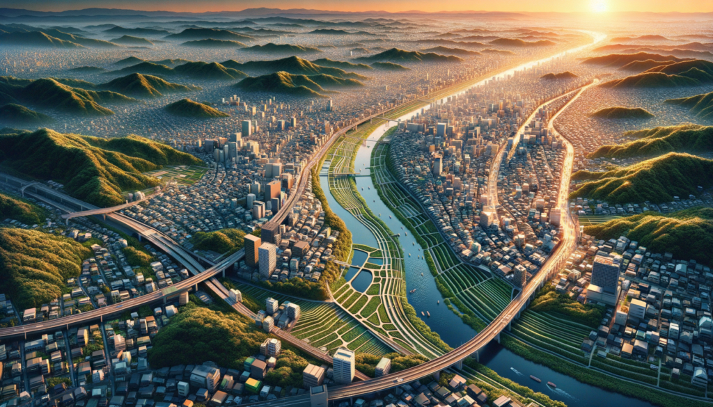
市域の東部は相模川に沿ったなだらかな階段状の河岸段丘から成り、これらの段丘の間には斜面緑地が連なっています。また、地盤が良い相模原台地の上段では、公共施設や商業施設などが集積し、都市機能が充実しています。
一方、市域の西部には相模湖、津久井湖、宮ヶ瀬湖などの湖があり、その周囲や相模川、道志川、串川の流域に広がる丘陵地には、自然と共生する豊かな緑のまちなみが形成されています。この地域は国定公園や自然公園にも指定されており、森林地帯が貴重な自然環境を守っています。
Sagamihara City is located within a radius of about 30 to 60 kilometers from the heart of Tokyo and approximately 25 kilometers from the center of Yokohama, in the northwest part of Kanagawa Prefecture. It borders Tokyo to the north (Machida City, Hachioji City, Hinohara Village) and Yamanashi Prefecture to the west (Uenohara City, Doshi Village). The city's transportation network is directly connected to the heart of Tokyo through the Odakyu Line, Keio Line, JR Chuo Main Line, and Chuo Expressway.
The eastern part of the city consists of gentle terraced riverbanks along the Sagami River, with sloping green spaces nestled between these terraces. On the upper level of the Sagamihara Plateau, where the ground is stable, public facilities and commercial establishments are concentrated, enhancing the urban functions.
On the other hand, the western part of the city features lakes such as Lake Sagami, Lake Tsukui, and Lake Miyagase, surrounded by hillsides extending along the Sagami River, Dozhi River, and Kushigawa River basins, creating a rich green landscape that coexists harmoniously with nature. This area is designated as a national park and natural park, preserving valuable natural environments in the forested areas.
相模原市位于东京市中心以东30公里至60公里之间,距离横滨市中心约25公里,位于神奈川县西北部。北接东京都(町田市、八王子市、檜原村),西接山梨县(上野原市、道志村)。市内交通网络由小田急线、京王线、JR中央本线和中央高速公路直通东京市中心。
市区东部沿相模川形成了缓坡状的河岸阶地,阶地之间连绵着斜坡绿地。在地基良好的相模原台地上层,集中了公共设施和商业设施,城市功能得到充实。
另一方面,市区西部有相模湖、津久井湖、宫ヶ瀬湖等湖泊,周围以及相模川、道志川、串川流域的丘陵地带形成了与自然共生的丰富绿色景观。这一地区被指定为国定公园和自然公园,森林地带保护着宝贵的自然环境。
※これらのコラムは弊社作成の情報を元に生成 AI により作成、翻訳されたものです